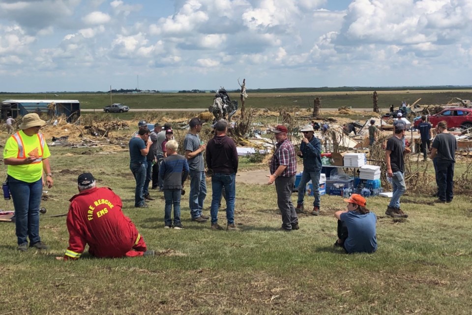
MOUNTAIN VIEW COUNTY - Scores of local volunteers and others from beyond the region were continuing clean-up efforts Tuesday at farms and ranches heavily damaged by the Canada Day tornado north of Carstairs.
Clean-up crews were using trucks, ATVs, tractors, wheelbarrows, other farm equipment, and their bare hands to gather debris and place it in piles for eventual removal.
“It’s terrible and so close to home,” said Carstairs resident Brittany Gates, who was helping with cleanup at one of two heavily damaged properties on Highway 2A. “It's amazing to see the community come together. I was off work today so I came out.”
Linden-area residents Ben Campbell and Ryan Toews were also helping with the cleanup Tuesday.
“We came out to see what we can do to help out,” said Campbell, a member of the Linden Mennonite community “We are here for the day to see if we can brighten their day a little. We do what we can when we can.”
The large tornado swept through Mountain View County around 2 p.m. Saturday.
The Western University Northern Tornadoes Project (NTP) has determined that the tornado was an EF4 on the Enhanced Fujita scale, making it the strongest Alberta tornado since Edmonton in 1987, according to the organization’s report posted on its website Tuesday.
An NTP ground crew has conducted a preliminary survey of the damage, finding evidence consistent with maximum winds of 275 kilometres an hour, making the tornado an EF4 on the Enhanced Fujita Scale.
"Climatologically, the Didsbury EF4 tornado enters some rarefied territory among Canadian tornado events," according to NTP.
The organization said it is one of only three tornadoes rated F/EF4 in Alberta (the other hit the Grassy Lake area in 1915).
The tornado grew to an estimated 620 metres wide and carved a path across the Alberta landscape measuring 15.3 kilometres long, the NTP said.
Although many residences in the vicinity were impacted with various degrees of damage, the most substantial area affected was located between Rge. Rd. 22 and Rge. Rd. 12, and between Twp. Rd. 304 and Twp. Rd. 310.
More than a dozen homes were heavily damaged in the storm, with five of those completely destroyed, say police. As well, 25 cows and 20 chickens were killed on properties hit by the tornado.
Debris from the storm was spread over a large area, with broken household items mixed with shattered fence posts and trees, shingles, hay and straw, and crushed and pulverized cars, trucks and farm machinery.
Across Canada, there have been only 21 'violent' tornadoes rated at F/EF4 or higher. One of these was Canada's only tornado rated at F5 - the Elie, Manitoba tornado of 2007. Most of the others (12) have been in southern Ontario. Saskatchewan and Manitoba have also experienced F4-rated tornadoes.


